Let’s edit geographical information
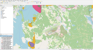
Many organizations who need to manage accurate point or polygon type of data need professional tools to do so. QGIS open source software has evolved and become very popular to create and maintain geographical data. Profium Sense Graph Database works well with QGIS and provides a safe solution for such data. You can make that data available in various online services either by fetching relevant data from a given area or to provide data for users based on their real-time location. We can make Profium Sense Graph Database available for you via a cloud deployment or you can install it to your on-premise environment. From QGIS users’ perspective the communication between the two is as simple as defining a single WFS endpoint to QGIS.
The types of use cases these two support include storing the exact coordinates and attributes of real-life objects on roads or parks. A plowing truck can then be provided with an accurate description of a route to drive or indication about objects to watch out next to the roads. The plowing truck need not have a laptop with QGIS installed but the route and obstacles can be visualised with Web browser on a mobile device, be that a table or a mobile phone.
Another use case for you could be storing of exact cable lines on the ground to prevent costly mistakes of breaking cables when digging ground for new fiber cables, for example. Maybe you already have that data available and would like to develop new services for various stakeholders?
In addition to managing geographical objects with location and attributes, Profium Sense Graph Database supports linking such objects with rich digital assets. You can provide users with links from a geographical object to, let’s say videos about an area before you start plowing a road or digging a new hole in a park. Adding new videos and pictures can naturally be done with a Web browser without having to install or start QGIS for users who do so.
We will be happy to organize you a demo session to show the interplay of these two!